Sunday, April 29, 2012

Summertime heat persists with a chance of showers and storms on Tuesday

Highlights:
Monday:  Partly to mostly sunny.  High near 88 with a low around 63
Tuesday:  Mostly cloudy with thunderstorms possible.  High near 85 and a low around 65.
Wednesday:  Mostly sunny.  High near 90 with a low around 68

Forecast:
An abnormally warm pattern for late April and early May is in store for south central Kentucky for the next week or so.  Temperatures in the high 80s, possible reaching 90 in places, are 10 to 15 degrees above normal for this time of the year.

With the jet stream stationed north of the Canadian border and continual height rises expected throughout the week, the anomalous heat we're experiencing doesn't appear as if it's changing any time soon.  Monday's forecast will include partly to mostly sunny skies as the frontal boundary oriented from the Oklahoma panhandle northeast to the Iowa/Illinois border and eastward through the Bluegrass migrates east-northeastward.  We will likely see some cloud cover and even a shower or two during the overnight as convection from the west travels eastward.

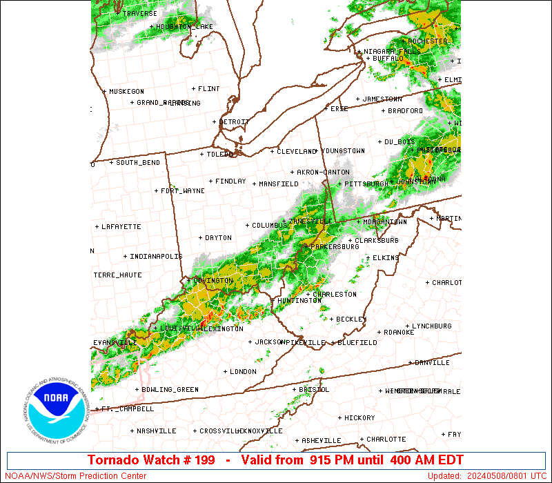
Tuesday looks to be our best shot at some rain and a very brief respite from the heat.  Showers are expected after moisture advection from the Gulf of Mexico continues to desabilize the boundary layer.  After the front lifts further northward, a strengthening ridge should keep us dry for the rest of the week.


The next forecast will be issued Thursday, and any new developments will be posted to our social media sites.
Lead Forecaster:  Jeremy Young

Saturday, April 28, 2012

Severe threat for Saturday evening / Slight risk for Sunday

As we get nearer to sundown, what threat that existed for severe weather will continue to decrease.  Currently, a severe thunderstorm watch and a tornado watch are in effect for areas to our north, much closer to the frontal boundary oriented from Louisville east-southeast toward Richmond.  Here are links to the severe thunderstorm watch and to the tornado watch.  A strong cap is in place over most of south central Kentucky, including Bowling Green and all of Warren County.  Considering this and the relative lack of moisture (see the image below), we should continue to have calm weather until tomorrow.
Surface winds and 850 mb winds have transported the majority of the moisture in the region to our north, supplementing the storms crossing the Ohio River at the moment.  The dark green areas show dewpoints in the 60º F to 64º F range
Tomorrow is another day that places us under a slight risk for severe weather, but once again we're along the boundary of the warning.  Models show the cap that has protected our portion of the state eroding by the early afternoon tomorrow, possibly as early as 10:00 AM.  We'll have plenty of moisture and have that moisture supplemented by southerly flow as the day progresses.  Effective shear values in the 30 to 50 knot range should help to organize storms that develop.  Ultimately, unless we have some clouds and precipitation advect into the area between tonight and tomorrow morning, the stage will be set for storm development.

Tomorrow's threats still look to be large hail and damaging winds.

Lead Forecaster:  Jeremy Young

Thursday, April 26, 2012

When will this front make up it's mind??


Highlights:
Thursday:  Partly to mostly cloudy.  Breezy, with a high near 79 and a low around 49.
Friday:  Mostly cloudy with a slight chance of storms.  High near 73 and a low around 60.
Saturday:  Partly to mostly cloudy with a slight chance of storms.  High near 79 and a low around 56.
Sunday:  Mostly cloudy.  High near 73 and a low around 50.
                                                                                                                                 
Forecast:
Relatively zonal flow aloft will persist into the weekend, with a high amplitude ridge dominating the weather across the country’s midsection. 

Rain chances will continue to be present for the next several days as a frontal boundary migrates slowly to the east and another storm develops over the south.  The cold front situated across the Ohio River should continue to advect southeastward throughout the day, exit the state by Thursday evening and then will be lifted slightly northward again, finally stalling near the Kentucky/Tennessee border.  Scattered convection generated by the oscillation of the frontal boundary could cause isolated severe storms to develop.


A surface analysis for Friday evening shows a frontal boundary south of Tennessee that won't quite leave us alone.


Lead Forecaster:  Jeremy Young

Monday, April 23, 2012

Chances of rain for most of the week

Highlights
Monday:  Mostly sunny.  High near 62 with a low around 40.
Tuesday:  Partly cloudy with a slight chance for showers.  High near 64 with a low around 49.
Wednesday:  Mostly cloudy early with a better shot at rain.  High near 80 with a low around 62.

Discussion
Over the next few days, the high amplitude trough that brought the much cooler temperatures to the state during the weekend will deepen and slowly slide eastward.  The very meridional pattern across the United States, which currently features a ridge across the country's midsection, won't change much until later this week.  Strong northerly winds that brought the cold air advection will transition to more of a westerly pattern by late Tuesday, possibly advecting enough moisture eastward for overrunning to create a shower before the trough exits.  Early Wednesday, a warm front will lift north of the area, warming temperatures again to levels slightly above average until a trailing cold front propagates through the state.  Moisture will be a limiting factor for any severe weather threat given the short amount of time available to destabilize the atmosphere.  Nonetheless, rain chances will persist into the next forecast period.

Lead Forecaster:  Jeremy Young

Thursday, April 19, 2012

Forecast for Thursday, April 19 through Sunday April 22

Highlights:
Thursday:  Sunny skies.  High near 80 with a low around 50
Friday:  Partly to mostly cloudy, chance of showers late.  High near 78 with a low around 52.
Saturday:  Cloudy with scattered showers.  High near 62 with a low around 40
Sunday:  Sunny with a high near 70 with a low around 45.

Discussion:
A zonal upper-level wind pattern will change as the weekend approaches when a trough ejects from west of the Dakotas.  The trough axis looks to be oriented from the Minnesota/Wisconsin border southward toward eastern Texas on Friday afternoon, possibly providing enough lift for an afternoon thunderstorm.  Attendant to the trough is an approaching storm system that looks to affect the area during the overnight hours on Friday and possibly into the early morning on Saturday.

HPC's surface analysis for Friday morning shows what will likely be a broad swath of rain approaching during the day.
As the front slides to the east, the front will stall upstream of high pressure in the Atlantic, allowing for lingering moisture to keep cloud cover and showers around during most of the day Saturday.  By Sunday, however, showers will cease and clouds will slowly exit.

Lead Forecaster:  Jeremy Young

Monday, April 16, 2012

Forecast Monday, April 16 through Wednesday April 18


Highlights:
Monday:  Partly cloudy.  Highs near 73 with lows around 50.
Tuesday:  Partly cloudy.  Highs near 73 with lows around 50.
Wednesday:  Mostly sunny.  Highs near 76 with lows around 48.

Discussion:
An approaching shortwave will contribute to cloud cover for the majority of Tuesday, but surface high pressure will be the dominant feature for the beginning part of the week.  The strong system that spawned the severe weather in the Plains earlier this week will follow a strong jet streak oriented from the Ohio Valley north-northeastward into eastern Canada.  After this afternoon’s passage of a cold front associated with the storm, northeast winds will transition to northerly and northeasterly as high pressure slowly slides eastward.  The wind pattern will help to mitigate any significant warming until Wednesday, at which time an approaching system will help to lift a warm front north of the area.  For the next couple of days, temperatures will stay within a few degrees of normal, until another brief rise late Wednesday and into Thursday as the storm to the west brings another chance of rain to the area for Friday.  

The HPC's surface map for Wednesday shows a storm developing just north of Nebraska that will serve as our next shot at rain.

Lead Forecaster:  Jeremy Young

Thursday, April 12, 2012

Warming up, some clouds and a chance for rain coming Monday

Highlights:
Thursday:  Sunny skies.  High near 65 with a low around 35.
Friday:  Mostly sunny skies.  High near 73 with a low around 50.
Saturday:  Mostly to partly sunny skies.  High near 83 with a low around 60.
Sunday:  Mostly sunny skies.  High near 80 with a low around 60.

Discussion:
Heading into the weekend, our weather will quickly get back to normal.  A deep, slow-moving trough over the west coast will advect eastward by the end of the weekend, but until it does, a ridge will be dominating our weather.  The surface low attendant to the trough is currently over the Kansas/Colorado border.  Return flow from the Gulf will help to quickly rebound our temperatures back to normal for this time of the year.  Because of the moisture advection from the Gulf and a warm front that should lift north of the state by early Saturday, gradual warming for the next few days, calm weather and a few clouds late this weekend will turn into increased cloudiness Saturday and a chance for rain beginning early next week.

Day 3 Fronts and Pressures
A look at Saturday's surface map shows the warm front lifting north of us by the early morning hours.

Lead Forecaster:  Jeremy Young

Monday, April 9, 2012

Forecast Monday, April 9 through Wednesday April 11

Highlights:
Monday:  Sunny skies.  High near 77 with a low around 43.
Tuesday:  Sunny skies with possible frost overnight.  High near 67 with a low around 35.
Wednesday:  Sunny skies with possible frost overnight.  High near 63 with a low around 33.

Discussion:
A calm and seasonable forecast is in store for Warren County over the next three days.  A cold front will move across the state today, but will encounter little moisture, meaning its only impact will be to lower our temperatures to slightly below average.  Mostly sunny skies and slightly cooler temperatures will prevail until the end of the week, providing perfect conditions for being outside and enjoying the springtime.  The only area of concern for the county, and most of the state, is the potential for patchy frost to develop overnight Tuesday and overnight Wednesday.  Clear skies during the overnight hours and strong northwest to northerly winds will provide perfect conditions for radiational cooling and frost development in areas.

Day 3 Fronts and Pressures
A look at the surface map for Wednesday shows high pressure continuing to dominate our weather.

Lead Forecaster:  Jeremy Young

Wednesday, April 4, 2012

Frost expected Friday and Saturday. Highs back to normal for remainder of week.


Highlights:
-Chance of precipitation Thursday
-Much cooler temperatures expected Friday and Saturday morning
-Highs returning to average


Discussion:
Skies will be mostly cloudy to overcast for the duration of the night and morning as light to moderate showers continue to develop on radar across the western portion of Kentucky.   Light showers are not out of the question for us as well for the duration of the day on Thursday as the closed low pressure system that has been located across the plains quickly traverses eastward and is once again re-absorbed into the general flow, but any precipitation we receive should accumulate to less than a tenth of an inch.    Highs look to be much cooler than as of late only reaching the mid 60’s Thursday under the influence of the cold core 500mb low pressure system and overcast skies, with lows in the mid 50’s Thursday morning and falling to the upper 40’s around the midnight hour.  Things get really interesting during the overnight hours Friday.  As the closed low pressure system is absorbed within a trough swinging through the eastern half of the United States, it starts to deepen and strengthen.  As this occurs, our placement in relation to the trough will allow cold air from Canada to pool into the Kentucky region as well as the eastern half of the United States.  

500mb projected heights and winds for Friday at 12Z.  This setup will send cold air from
Canada down south into our region 
Temperatures don’t look to reach the freezing mark, but frost will still be a likely occurrence under the presence of clear skies with light winds and the temperature approaching the dew point.  The low Friday morning looks to be a chilly start to the day in the mid 30’s and clear skies for the duration of the day, but temperatures will rebound back into the mid 60’s for the high.  Saturday looks to bring little change from Friday with highs still in the mid 60’s and lows in the upper 30’s.  Frost is also a possibility Saturday morning with skies continuing to be clear, light wind speeds, and the temperature once again approaching the dew point.  The low Sunday morning should be much warmer because the upper level trough is forecasted to have sufficiently traversed to the east away from Kentucky.   Lows look to be in the upper 40’s, with highs approaching the upper 60’s mark Sunday.

Lead Forecaster:  Nathaniel Shearer

Tuesday, April 3, 2012

Slight risk for severe weather today...

The Storm Prediction Center has placed most of Kentucky, including Warren County, under a slight risk for severe weather today, as seen below.


Given that our forecasted high temperatures are in the mid 80s, it's possible for us to reach temperatures that will be conducive to convection.  Operational models vary significantly on whether or not any precipitation will fall across the county.  Both the NAM and the RUC model show a few hundredths of an inch falling, if any, while the GFS has about a quarter of an inch of rain falling, which would be more in line with the SPC thinking.

Currently, a strong cap is in place.  The high CIN values currently observed and those forecasted by the RUC model are expected to deteriorate as daytime heating continues, as shown in the following two images.

../GemPakTier/MagGemPakImages/ruc/20120403/14/ruc_namer_010_cape_cin.gif
1400 UTC RUC model CAPE/CIN Forecast
SPC Mesoanalysis of current MUCAPE/MUCIN

The HPC, RUC and NAM all keep Warren County dry, while the GFS is much more aggressive with it's precipitation forecast.  In lieu of this and the expected scattered coverage of any developing thunderstorms, the Stormtoppers will not be activating today.  

Thunderstorms that do develop late this afternoon and evening will pose a threat of small hail.  

Lead Forecaster:  Jeremy Young

Sunday, April 1, 2012

Above average temperatures continue and rain chances on the increase


An upper level ridge will continue to keep skies partly clear through the early part of the week as an amplified neutrally tilted trough continues to slide its way eastward across the United States.  As this trough moves eastward, a surface low pressure will quickly deepen and help temperatures continue to be above normal and closer to summer time average temperatures.  

Projected location of surface low pressure system
Strong warm air advections around this low will bring temperatures to the upper 80’s Monday while lows Monday morning will remain around the low 60’s.  Tuesday looks to be similar to Monday with high’s in the upper 80’s and lows in the mid 60’s.  Given that no convective inhibition is forecasted to cover the area, air mass thunderstorms cannot be ruled out through the duration of the afternoon Monday and Tuesday.  Tuesday afternoon introduces more difficulty to the forecast as a closed low pressure system makes its way across Kentucky.  All forecast models suggest a band of showers developing moving from southwest to northeast across the region beginning Tuesday night and these showers look to persist into the day early  Wednesday .  

ECMFW forecast for April 3rd at 10:00pm.  Shows 90% Relative Humidity over our region.
Courtesy Weather Underground 

NAM projected Composite Reflectivity.  The band of showers is also suggested in this model run
Temperatures Wednesday will be slightly lower under mostly cloudy skies in the upper 70’s, while lows will continue to be in the lower 60’s to upper 50’s.  As Thursday approaches, models differ on precipitation chances as the upper level remains over the area.  Updates to forecast will come Thursday. 

Lead Forecaster:  Nathaniel Shearer